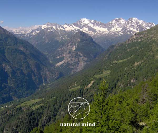
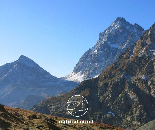
Maggiore lake and Ossola valleys
Lake Maggiore and its valleys are a treasure chest set in the far north of Piedmont, on the border with Switzerland.
There are numerous valleys that flow first into the Ossola plain and then into this beautiful lake. Here they are briefly described:
 Domodossola - the city of the market
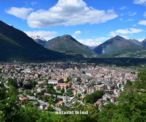
If Ossola is a range of valleys, its fulcrum is the DOMODOSSOLA basin, the familiar Domo, the convergence point of international roads with its lively Saturday market, the beating heart of the region, as Mortarotti defines it. The city lies on the dejection fan of the Bogna stream, which extends between Caddo and Mount Calvario. Sacro Monte Calvario is one of the Sacred Mountains of Piedmont included in the list of World Heritage Sites by UNESCO.
The Domodossola basin is however much wider: where the plain gives way to the mountain, the towns of Preglia, Crevoladossola, Montecrestese, Masera and Trontano rise in a crown.
The ancient Oscella dei Leponzi, later Domus Oscellae, was, until less than two centuries ago, a small village that did not exceed a thousand inhabitants. Starting from 1805, with the opening of the great Napoleonic road, the city began to overflow beyond the walls: a development that intensified after the arrival of the railway from Novara in 1888 and even more so with the entry into operation of the tunnel of the Simplon in 1906.
With the international railway, traffic and industry took shape, with the consequent increase in urban planning and demographics: today Domodossola has 15,000 inhabitants. The nerve center is the Piazza Mercato, characteristic with its fifteenth-century arcades in support of beautiful manor houses of the fifteenth and sixteenth centuries.
A short distance away is the collegiate church dedicated to Saints Gervasio and Protasio, rebuilt in the 15th and 18th centuries on a Romanesque building of which the heavily worked wooden portal remains.
The church of San Francesco was also of Romanesque origin, but it no longer exists, replaced by a building with the same name, seat of the Galletti foundation; museum that boasts more than one curiosity: the car with the number 1 plate of the province of Novara, the diligence and the Simplon sleigh that were in service until 1905, the room dedicated to the large tunnel, parts of Geo Chavez's airplane , which was the first flyer of the Alps in the early 1900s.
Palazzo Silva, a national monument, is Renaissance and was built starting in 1519 by the commander Paolo Della Silva, a nobleman in the service of Francesco I.
It houses beautiful furnishings in large noble halls, wooden sculptures, Crevoladossola marble coats of arms, an archaeological collection, paintings from the 16th to the 18th century, Ossola costumes, armor: in short, an extensive documentation of the history of this region very rich in history .
 Macugnaga - the pearl of Monterosa
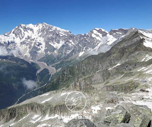
Heroic vision, the east face of MONTEROSA has aroused romantic comments and even a little rhetoric, not only among travelers in past centuries. In fact, it has no equal in the Alps, in terms of height and size: 2600m. of vertical glaciers for almost 4 km in length; a corner of the Himalayas on the doorstep.
So impressive and grandiose in Macugnaga, that it becomes the symbol and the major attraction, already from the Sempione state road, between the Masone bridge and Pallanzeno, the Monterosa lets you glimpse the crown of its 4 sisters enclosed by the green Anzaschino proscene; here from the left the Gnifetti 4559m., the Zumstein 4563m., the Dofour 4634m. and the Nordend 4609m.
But the view from Piedimulera is only a foretaste: along the 29 km of the valley the views extend to Pontegrande, Vanzone and Croppo up to the apogee of Macugnaga where the combination between the town and its great mountain is truly indissoluble.
MACUGNAGA is the most important and well-equipped tourist resort in the Anzasca valley.
Nature has been generous, but man has been able to preserve the landscape elements in their original integrity. An ideal stay for all seasons with hotels, pensions, typical restaurants, sports centers and climbing walls. However, the most fascinating gyms are the paths, the glaciers and above all the walls of Monterosa themselves, with the stories of its mythical conquests.
Among the ten or so refuges, the most popular are the Zamboni-Zappa refuge at 2070m., At the foot of the east face of Monterosa and the Eugenio Sella hut at 3029m., Both of which are kept in the summer. There are two cable cars and the same number of chairlifts. The former lead from Macugnaga-Staffa to the 2800m of Passo del Moro, an imposing balcony over Monterosa and its chain, on the border with the Swiss Saastal. The Gaspare Oberto-Maroli refuge and restaurant is located on the pass, just renovated and under new management. The chairlifts, on the other hand, rise from Macugnaga-Pecetto to touch the 2000 meters of the Belvedere, in front of the sinuous glaciers that introduce the world of 4000 meters.
For the long winter-spring ski season, a dozen ski lifts and 40 km of slopes cater for all tastes. There are two ski schools with the practices of related activities and the possibility of off-piste descents, cross-country rings and a beautiful ice rink for skating.
Culture, fun, relaxation and sport under the good-natured gaze of the great mountain. Two Walser museums, Staffa and Borca, arranged in old wooden houses, allow a direct approach to the traditions and peculiarities of the past, which also come to life in folkloristic events.
 Natural Park of the high Antrona valley
ANTRONAPIANA with its territory expands like a fan in the upper part of the Antrona valley which, in turn, branches off from the main Ossola valley, following the path of the Ovesca river.
The Antrona valley is one of the most beautiful and unspoiled in the Ossola valley. This situation today becomes a strength as it allows those who frequent it to enter a world in which the harmony between man and nature maintains an ancient balance.
The absence of glacialism and a good network of marked trails allow the practice of high-altitude hiking on mountains that are extremely rich in water and adventure.
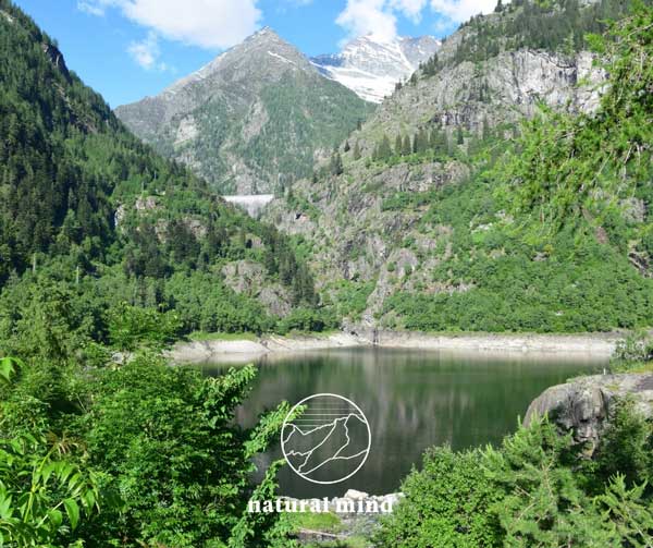
It is a world of large spaces, dominated by steep rock faces and large natural and artificial lakes. Campliccioli, Camposecco, Cingino and the Cavalli dam in Cheggio are the hydroelectric reservoirs present in the valley. They are not famous mountains, but they have their own strong identity, defined by the severity of the places and the vastness of the high pastures.
From Antronapiana a paved road leads in 7 km to CHEGGIO (1500m.) Once a large pasture, today a destination for walks throughout the year as the road remains open even in winter for skiing. From Cheggio you can drive up to the dam of the Cavalli dam, mentioned above, on the left of which the path leads that in 2 hours leads to the famous Andolla refuge.
The high degree of naturalness of the territory and its definition as a marginal area affected by intense depopulation processes propose the Antrona valley as a node of primary importance in an ecological network logic both with the nearby Italian protected areas (Parco Naturale Regionale Veglia and Devero and Valgrande National Park), and with the contiguous Swiss ones (Laggintal Nature Reserve and naturalistic site of raised bogs at Simplonpass / Hopschusee).
The recent establishment of the Alta Valle Antrona Natural Park, covering an area of 8,500 hectares, has allowed the creation of a new wilderness area in the Ossola valleys.
Back on the main road, from Antronapiana you can reach the lake of the same name at 1073m: a destination of high tourist value and environmental attractions suitable for satisfying the needs of the whole family.
 Bognanco - the valley of 100 waterfalls
VAL BOGNANCO is the Domodossola valley because it opens up green and restful immediately behind the Ossola capital. The city rises on the wide fan of the Bogna stream that runs through it, on the edge of the vast plain on which the other Ossola valleys converge in a radial pattern. The Bognanco valley is, due to its geographical position, an anomalous valley in the Ossola valley as it does not support its head directly in the Pennine Alps but is embedded between the secondary chains that descend from them and which separate it to the south from the Antrona valley. , to the east from the Vaira valley in Switzerland and to the north from the Divedro valley.
Numerous streams flow into the Bogna from the surrounding valleys, creating innumerable waterfalls near the rocky jumps, so much so that the valley has been defined with poetic verse "the country of a hundred waterfalls". The morphology of the valley presents an evident asymmetry that sees the right side short and steep, while the left one is disproportionately large and shaped into gentle shelves. All 21 lakes in the valley, some of which are very small, are located in the morainic amphitheaters which are repeated regularly on this side and which have been designed by an uncommon glacialism.
Until the 1920s, the inhabited centers were grouped as follows: Monteossolano, Bognanco outside and Bognanco inside, where the Bognanco thermal baths stood and the famous Ausonia purification water gushed out. Currently there is only one municipality, Bognanco, while the villages at the outlet have become hamlets of Domodossola.
The valley today offers an ideal terrain for hiking: none of its mountains touches 3000m., There are no permanent glaciers and snowfields. The environment consists of a dense network of paths that cross sweet and restful environments with a myriad of alpine lakes among dense woods and open spaces with still well-tended pastures.
 Val Divedro - a valley long like history
You enter VAL DIVERDO from Crevoladossola, where the Diveria stream flows into the Toce plain at the great Napoleonic bridge built on the ruins of the previous one from the 15th century. In Crevoladossola you can visit the sixteenth-century church of Saints Peter and Paul, with its splendid stained glass windows, or stop at the marble quarries that fed the cathedral of Pavia and Monza, as well as the basilica of Sant'Ambrogio in Milan.
The valley is wild and has no particular attractions as far as Varzo, a holiday resort with great traditions and the branching point of the road to San Domenico, a winter sports resort and in turn the starting point for Alpe Veglia. Alpe Ciamporino ski lifts are currently the newest and most innovative in the province of Verbano Cusio Ossola.
The great church of San Giorgio, Romanesque in its origins and subsequently remodeled, is located at the top of a long staircase: it appears suddenly, if you emerge from one of the very narrow alleys that form the reticulate of the small historic core.
The road (state road n ° .33) continues towards the border leaving Trasquera on the right. 17 km from Domodossola is Iselle, a boarding point for cars on shuttle trains through the famous Simplon tunnel. In Paglino there is the Italian customs and in Gondo the Swiss customs.
Continuing on, you will come across the town of Gabi (in German Gstein): it is a lovely center dominated by the Weissmiess 4023m: the mountain gives its name to an inn where everything talks about Napoleon and the road to Milan that he built.
According to tradition, the general stopped here on May 27, 1807: if you were born on May 27, do not miss the surprise that awaits you at the Weissmiess inn.
Going up again, Simplon Dorf, at 1480m., With a beautiful and secluded square with a gushing fountain in the presence of the 4000 of the Simplon.
Near the pass, on the left and below, the old hospice appears, announced by the Stockalper tower, while on the top of the pass stands the new hospice, begun by Napoleon and completed in 1831. On this side the Po 'basin, beyond the Rhône basin; on the one hand the Pennine Alps, on the other the Lepontine, according to the scholastic subdivision it would coincide with the Simplon Pass.
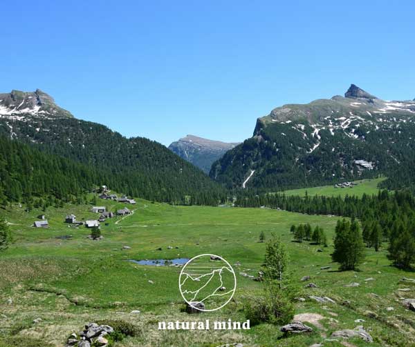 Alpe Veglia - the pastures of the sky
VEGLIA, at the head of the Cairasca valley, is a large basin of glacial origin surrounded by a chain of mountains that make up the western edge of the Lepontine Alps. They are beautiful and severe mountains that are distributed at an altitude higher than 3000m .; their connecting ridges mark the border with Switzerland. The region is dominated by the 3553m high Monte Leone: immense and omnipresent, the highest peak of the Lepontine Alps.
The only opening of the Veglia basin is to the south-east with the splendid Croppallo gorge that the water of the Cairasca stream has dug by carving easily eroded calcescists. It is a bastion of rock that separates Veglia from the plain of Nembro, 400 meters below. A dirt road that can only be traveled by off-road vehicles climbs it up on the right and is the only access to Krk.
However, it is passable only in summer because the avalanche danger prevents any winter access. For this reason, Veglia is a corner of the world that nature itself has been able to defend by granting it to the joy of men for a few months a year. For the other months it is snow and silence.
The difficult environmental conditions and impervious access have always limited human settlement to the summer period. Pasture is the dominant element of the Alpe Veglia landscape.
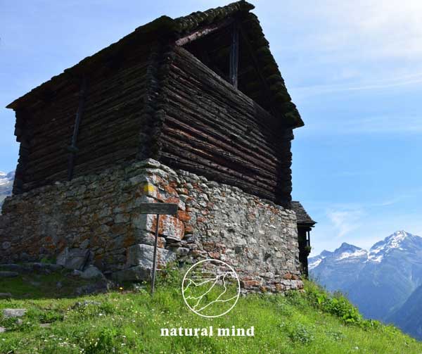
The groups of farmhouses of Cianciavero, Aione, Ponte, Isola, Cornù, Pian Stalaregno and La Balma, harmoniously inserted into the environment, are residential units all at the same elevation with the front of the huts overlooking the center of the plain. The gray local stone is the dominant construction material for which the huts and stables blend with the erratic boulders and the large walls of the surrounding mountains. This is the secret of the natural integrity of Alpe Veglia: the perfect harmony of man and nature, a world of balance that has disappeared elsewhere that the mountain people have built and preserved up to us.
The high degree of naturalness of the territory and its definition as a marginal area affected by intense depopulation processes propose the Antrona valley as a node of primary importance in an ecological network logic both with the nearby Italian protected areas (ParcoNaturale Regionale Veglia and Devero and Valgrande National Park), and with the contiguous Swiss ones (Laggintal Nature Reserve and naturalistic site of raised bogs at Simplonpass / Hopschusee). The recent establishment of the Upper Antrona Valley Natural Park, covering an area of 8,500 hectares, has allowed the creation of a new wilderness area between the Ossola valleys.
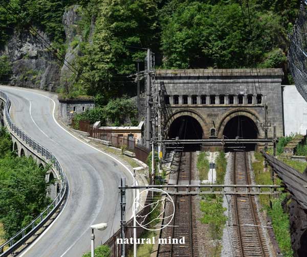 The Simplon tunnel
The cost of the enterprise touched 80,000,000 Swiss francs at the time. An entire town, called Balmalonesca, was built to house the six thousand workers: a double row of wooden houses along the main street, with the tailor, the barber, numerous taverns and a small church dedicated to Santa Barbara, patron saint of miners. After the opening of the tunnel, Balmalonesca was abandoned and later destroyed by the floods of the Diveria river.
The construction site, started on opposite sides in the summer of 1898, built two side-by-side tunnels over 19 km long, connected to each other by service tunnels.
The workforce was mainly Italian: expert workers, some of whom were veterans of the Cenisio and San Gottardo tunnels, under the direction of the German engineers Brandt and Brandau.
The works of the first gallery were completed on February 24, 1905. The inauguration was held on May 19, 1906, in the presence of King Vittorio Emanuele III and the President of the Swiss Confederation Ludwig Forrer.
On 1 June 1906, the Simplon Orient Express, the legendary train of rulers and adventurers, of the high society of the time that lived its "belle epoque" before the lights flashed on the horizon, entered operation along the new Simplon line left of the great war.
As a hundred years earlier, at the time of the first postal stagecoaches, the Simplon and Ossola saw the great traffic of travelers passing through Europe, from Paris to Venice and from London to Istanbul.
 Antigorio and the pastures of the Walser shepherds
VALLEY ANTIGORIO in practice is the continuation of the Ossola valley towards the Formazza valley. There are two characteristic elements that can be found in this valley: the ravines of Uriezzo and the pastures of Salecchio.
In the valley between Premia and Crego, the millennial flow of the Toce river has deeply carved out the living rock, giving rise to deep gorges.
The most curious gorge is that of Uriezzo.
It is formed by a sinuous and bizarre series of four grandiose fluvial-glacial potholes on a line of 150 meters. The first measures about 5 meters in diameter and 12 meters deep, the second 4 and 16, the third 8 and 16, while the fourth is oval in shape with the major axis of 30 meters, the lesser of 12 meters and the height also of 12 meters. An iron staircase facilitates the connection between the last two.
Returning to the main road in the valley and continuing north we arrive at the crossroads that leads to Salecchio.
Invisible from the valley floor, above the rocky base we find Salecchio divided into two small nuclei: Salecchio Inferiore and Salecchio Superiore in which centuries ago a Walser community lived in complete autonomy.
"It's just an alp on a high mountain", this is how this tiny municipality was briefly described, autonomous for seven centuries and only aggregated to Premia at the end of the 1920s. In winter the town remains uninhabited, but Candlemas is celebrated on the first Sunday in February (lately it is celebrated later after a few weeks) with a procession, music and party. The crossing from Salecchio Superiore to Cà Francioli and to the Vova pastures is very beautiful, from where you can descend to Chioso and then return to the state road at the bottom of the valley.
 Alpe Devero - the flowery alp
The DEVERO PLATEAU, of glacial formation, is undoubtedly one of the most picturesque places in Ossola. It is a wide prairie dotted with alpine cottages and huts surrounded by waterfalls and coniferous forests and sublime pinnacles dominated by Mount Cervandone which reaches 3211m. of share. In winter it is one of the most popular resorts in Ossola for skiers and snowshoers.
There are easy snow fields for beginners and daring descents for experts, rings for cross-country skiing and trails for ski mountaineering.
From Baceno, to go to Devero, turn left; the road is flanked by the chapels of an ancient Via Crucis. You reach Croveo where, in the small churchyard, a monument depicts Don Amedeo Ruscetta, the priest-viper.
Parish priest of the town for over half a century who taught the dangerous art of capturing live vipers. The reptiles were then sent to the Italian and foreign serotherapy institutes.
After Croveo the valley narrows and, after passing the remains of a fifteenth-century tower, a strategic barrier against the descents of the Valais troops, you go up to Goglio. Continuing on the right for the carriage road in a quarter of an hour you will reach Devero. Alpe Devero, at an altitude of 1635m, or "alpe fiorita", is the most magical place in the Antigorio valley.
The recommended destinations are: the hamlet of Crampiolo with the adjacent Codelago basin for the production of electricity, behind which stands Punta Arbola; the lake of witches, the wild deserted valley, the Nero lake.
Of great importance are the classic traverses Devero-Formazza, Devero-Veglia and Devero-Binn in the Valais. The trails are well tested and equipped and there are excellent support points during these crossings which generally require two days of walking. That the area was very popular is confirmed by the discovery, on the way to the Marani Pass, of a dagger from the Bronze Age that may have belonged to a crystal hunter.
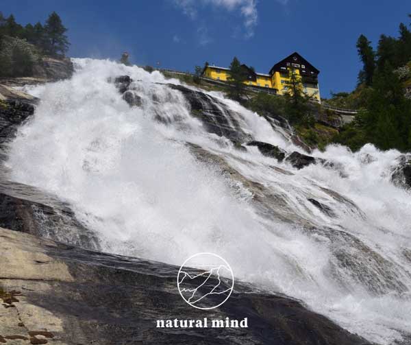 Val Formazza - the queen of the alps
The Pomatt valley, the Walser name of FORMAZZA, was visited at the end of the 1700s by Orazio Benedetto de Saussure, the "father of mountaineering". The history of the village is made up of very intense relations with the neighboring valleys, especially with the Valais Goms.
In Ponte, the Forte house from 1569, transformed into an ethnographic museum, in the past performed the most varied tasks: seat of the municipal assembly, goods storage, prison and court. The major attraction of Val Formazza is the famous waterfall of the Toce river, considered by many to be "the most beautiful and imposing in Europe": it measures 143 meters high, while the width varies from 26 meters at the top to 60 at the base. .
Formazza is considered one of the places of origin of Italian cross-country skiing, since in March 1909 three Swiss from Airolo descended with special woods from Passo San Giacomo, amidst the incredulity of the people. The carpenter Guido Matli immediately made a few pairs of skis and the parish priest Don Rocco Beltrame founded the Formazza ski club with Antonio Della Vedova.
Above the waterfall a second plateau opens up which ends in the Riale basin. We are at 1740m. in an enchanting place, especially with early summer flowering.
Here the road forks: on the left, asphalted, it reaches the Morasco dam; starting point for the Città di Busto, Somma Lombardo, Mores, Claudio and Bruno and 3A huts. On the right, an unpaved road leads to the Maria Luisa refuge, to the Toggia dam and to the San Giacomo Pass, and then to Val Bedretto in Switzerland. The region is dominated by Mount Basodino, on the border with Alta Valmaggia.
 Val Vigezzo - the valley of Painters and Chimney Sweeps
LA VIGEZZO is a valley that thrives on tourism and border crossing, boasts a brilliant emigration that over the centuries has produced important inventions and returning well-being. The valley tells the legend of the chimney sweeps and a tradition of great artists (in the last century there were 7 painting schools in the valley).
Compared to the other Ossola valleys, the Vigezzo valley has an original aspect: it does not appear as a deep and deep groove, but its center is located in an airy plateau just over 800 meters above sea level, green with intense shades of the woods and the softer ones of the pastures, which fade at the top into the softened polychromies of the rocks.
This is the Vigezzo palette, which a correct slogan indicates as the "valley of painters". The valley also enjoys an easy geographical opening towards the Canton of Ticino, to which it is connected by the state road and the famous Domodossola-Locarno railway. A second opening opens towards the Cannobina valley.
An undoubtedly original feature is given by the two streams that crisscross the valley, curiously called with the same name: Melezzo, even though they descend in opposite watersheds: towards Domodossola the Western Melezzo, towards Switzerland the eastern one. The tourist-accommodation facilities consisting of hotels, pensions, apartments, campsites, restaurants, a gondola with ski lifts to the Piana and cross-country skiing trails in the valley, is able to optimally meet the needs of a mid-mountain holiday for the whole family.
Val Vigezzo begins at Masera. The central plateau of the valley gathers the most important centers with the municipal offices of Druogno, Santa Maria Maggiore, Toceno, Craveggia, Malesco, Villette and Re. To admire the gigantic chestnut trees and centuries-old beech woods: a sort of patriarchal family of the Vigezzo vegetation .
Re, at 710m., Identifies with the sanctuary of the Madonna del Sangue, a religious reminder that comes from afar, when in 1494, blood gushed from the wounded forehead of the Virgin. The picture of the miracle is kept in the great basilica. Without purely mountaineering peaks, Val Vigezzo offers numerous and interesting excursions that can be enjoyed by a large number of enthusiasts. A good network of well-kept and signposted trails allows you to combine the pleasure of walking in open and grandiose environments with the adventure of discovering ancient traditions and settlements.
 Valgrande is the largest wilderness area in Italy
THE VALGRANDE NATIONAL PARK, established in 1992, is the second national park in Piedmont (after the historic one of the Gran Paradiso) and protects the largest wilderness area in the Alps.
A "returning wilderness" where for forty years man has not worked or intervened on ecological balances. It is a valley accessible only through passes reachable after a few hours of walking, surrounded by low mountains: the highest peak is Mount Togano 2301m. After centuries of intense exploitation by woodcutters, charcoal burners and mountain dwellers, silence has returned to the valley and nature has freely resumed its course, regaining possession of the territory.
A good signposted trail network allows you to travel through the large beech woods that cover the valley, the kingdom of the eagle and chamois. The thematic visitor centers of the Park offer information and allow a prior knowledge of the environment. In the 1990s, the park set up 13 nature trails: short itineraries suitable for everyone, equipped with illustrative panels on the history and nature of Valgrande, provided by practical educational guides.
The outings take place in the woods and around rural villages such as: Trontano, Santa Maria Maggiore, lower Valgrande, Val Pogallo, Alpe Prà, Pizzo Faiè, Premosello, Vogogna and Pian Cavallone. An easy path to discover the largest wilderness in the Alps and in Italy.
The crossing of Valgrande, from Val Loana in Vigezzo to Colloro to Premosello, is the most complete and famous excursion in the National Park: the paths are evident and well marked, wooden walkways allow you to easily cross the streams and cozy bivouacs for overnight stays they are present all along the route.
During the crossing you will touch the integral reserve of the Pedum, the first established in the Alps: almost a thousand hectares of territory where nature freely follows its evolution. All these aspects make Valgrande a great pole of attraction for lovers of unspoiled nature: the trails are always very popular throughout the year.
There would still be a lot to say about these valleys, perhaps little known, but really full of stories and places to be enchanted by their rare beauty.
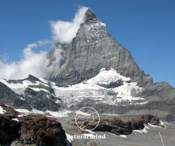 Cervino east face - swiss side
CERVINO TOUR AND MONTE ROSA TOUR
They are two great high altitude treks around Monterosa and Matterhorn. Intact nature, a thousand emotions to be savored in a region populated by the Walser. A path that emanates a particular fragrance of essences and perfumes.
These great tours present versatility, the simplicity of local gastronomy, the richness of flora and fauna and the uniqueness of the cultural, historical and architectural heritage.
To find out more contact me or visit this website: www.tourducervin.ch and www.tmr-matterhorn.ch
 The Monviso climbing towards the Colle delle Traversette
MONVISO TOUR
The first documented Face Tour was carried out by the Englishman David Forbes with a local guide on 1 July 1839.
In the twentieth century, the Giro di Viso became a "classic" of hiking; already known to Italian hikers in the 1960s, it was popularized by French hikers starting in the 1970s.
The ring of several stages around the Monviso represents one of the most spectacular high altitude treks in Europe offering panoramic views of the different profiles of the "King of Stone" and the experience of nature, protected by two natural parks where the they change all the time.
Along the way you meet the bold rocky walls of the southern massif, the crystalline lakes with green-blue reflections of the Vallone delle Giargiatte, the twisted stone pines of the Alleve wood and the splendid water mirrors of the upper Po Valley.
Also noteworthy are the panoramic "Sentiero del Postino", the historic Buco di Viso, the vast areas of Queyras and the exceptional viewpoint of the Losetta peak.
It is possible to take the Gran Tour of Monviso starting from one of the Italian valleys: Valle Po, Valle Varaita, or Valle Pellice or from Val del Guil in France.
The complete ring can take from two up to a maximum of six days.
Having 4 or 5 days available, it becomes very interesting to make the complete loop which also includes the upper Pellice valley, passing through the splendid and bucolic Conca del Prà and the Barbara Lowrie refuge. To find out more contact me.
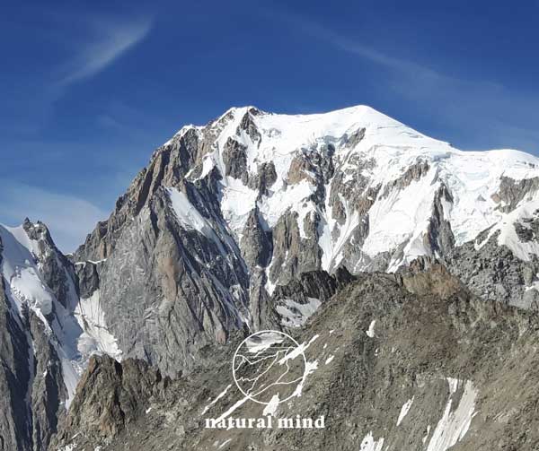 Mont Blanc from the Italian side of Courmayeur
MONTE BIANCO TOUR
The Giro del Monte Bianco (in French Tour du Mont-Blanc) is a hiking route around the Mont Blanc massif of about 170 km between Italy (Valle d'Aosta), France (Haute-Savoie and Savoy) and Switzerland (Valais).
To find out more, contact me or visit the website www.autourdumontblanc.com
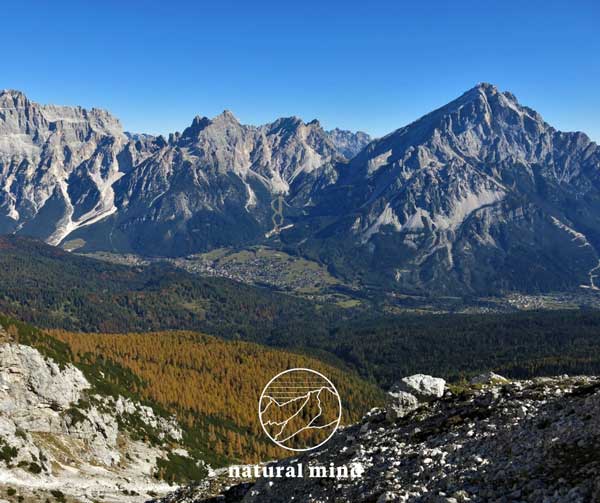 Cortina d'Ampezzo - Dolomiti UNESCO
 DOLOMITI UNESCO
The Dolomites occupy the eastern sector of the Alps chain, entirely in the Italian territory of the Provinces of Bolzano, Trento, Belluno, Pordenone and Udine.
The two main characteristics that these mountains have in common are the daring morphology (spiers, pinnacles) and above all the mineralogical composition: they are in fact partly made up of dolomite (double carbonate of calcium and magnesium).
The Dolomites are geologically bounded to the north by the Faglia della Pusteria and to the west by the Giudicarie Line, which separates the Adamello-Cevedale-Ortles chain from the Brenta Group, which rises to the west of the Adige furrow.
The entire region is therefore included between the Val Pusteria to the north, the furrow of the Piave to the west (with the appendix of the Oltrepiave and Friulane Dolomites), the Val Belluna crossed by the Piave and Val Cismòn to the south, and the furrow of the 'Isarco and Adige to the east (with the appendix of the Brenta Group).
There are 9 mountain ranges protected by UNESCO:
1. Pelmo, Cernèra, Croda da Lago, Formìn
2. Marmolada, Vernèl
3. Central Dolomites: Pale di San Martino, Focobòn, Pale di San Lucano, Agnèr, Civetta-Moiazza, Tàmer-San Sebastiano, Spiz di Mezzodì-Prampèr, Talvena-Pelf, Schiara, Monti del Sole, Vette Feltrine.
4. Friulian and Oltrepiave Dolomites
5. Northern Dolomites: Dolomites of Boite, Ampezzo, Cadini di Misurina, Tre Cime di Lavaredo, Popèra-Sesto Dolomites, Fànes-Sennes-Braies, Cunturines
6. Pùez-Odle, Sass Rigàis, Sassòngher
7. Catinaccio, Scìliar, Vàjolet, Làtemar
8. Rio delle Leaves / Bletterbach
9. Brenta Dolomites
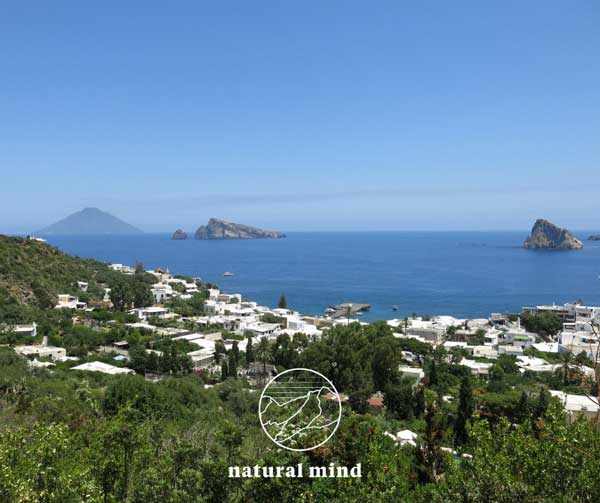 Panarea and Stromboli in the background - AEOLIAN ISLANDS
 THE AEOLIAN ISLANDS: THE DAUGHTERS OF FIRE
The seven sisters: Filicudi, Alicudi, Panarea, Salina, Lipari, Vulcano and Stromboli, with always strong and bright colors at all hours of the day and night, very different from each other, but united by an overwhelming beauty that makes anyone who visits them fall in love .
Aeolus god of the winds fixed his abode here. They all belong to a single volcanic complex. Lipari and Vulcano have many eruption materials such as pumice.
These islands were probably formed by strong lava flows that reached and exceeded sea level. It is wonderful to analyze and pause to look at the morphological configuration of the seabed in the Aeolian archipelago.
All the excursions on these islands satisfy with very suggestive panoramas.
To find out more about the visit programs to this crazy volcanic archipelago do not hesitate to contact me.
All these places described so far are the "tip of the iceberg" of a series of endlessly imaginative proposals thanks to the beauty of the Italian mountains and the Alps in general.
Surprises, discoveries and adventures are also planned in the sunny Ligurian lands and the Côte d'Azur as well as around the other great massifs of the Alps such as Gran Paradiso, Ortles and Bernina, the most "eastern" 4000 of the Alps.
From the mountains to the sea on the island of Elba or along the Amalfi coast to the Nebrodi mountains in front of Etna! Even the proposals for trekking by the sea contain many other wonderful places to visit and get to know.